Water
Water Expertise
Water is our most valuable resource. It plays a vital role in maintaining a healthy ecosystem and quality of life across our communities. To protect it, our water resources team designs comprehensive solutions that focus on innovation, sustainability, and regulatory compliance to enhance water quality, safeguard public health, and promote environmental stewardship.
ISG can help you create sustainable water management systems and preserve your natural resources for a resilient and thriving community.
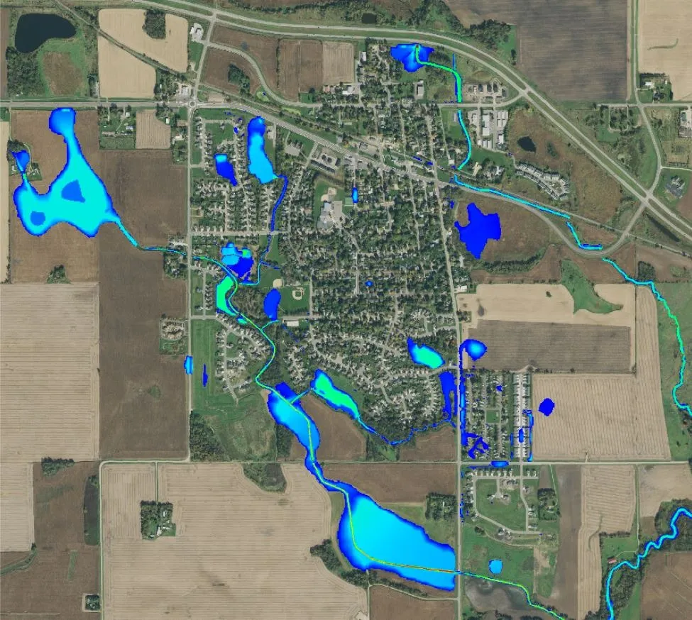
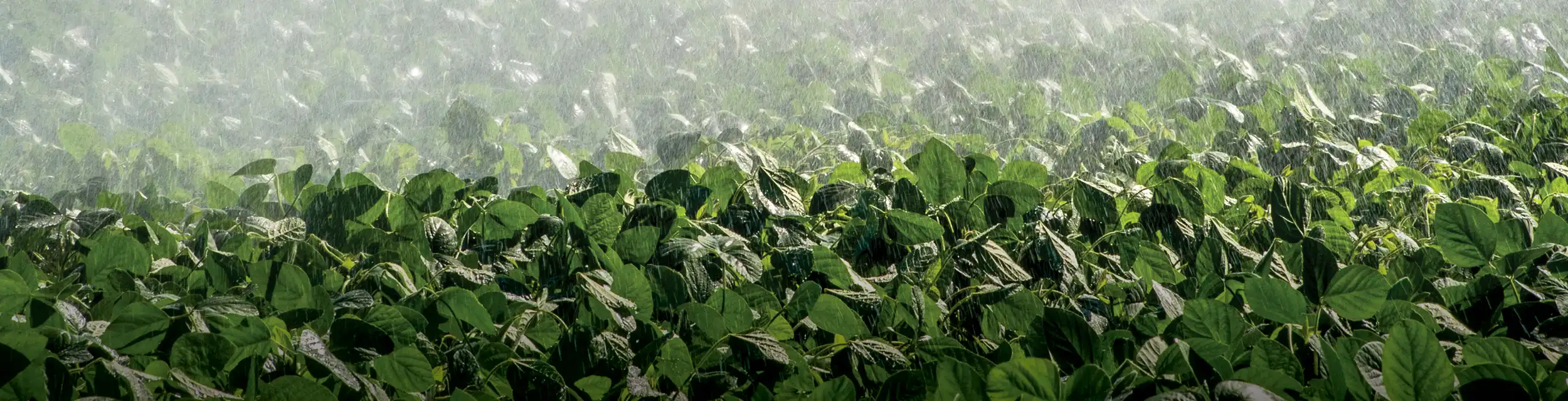
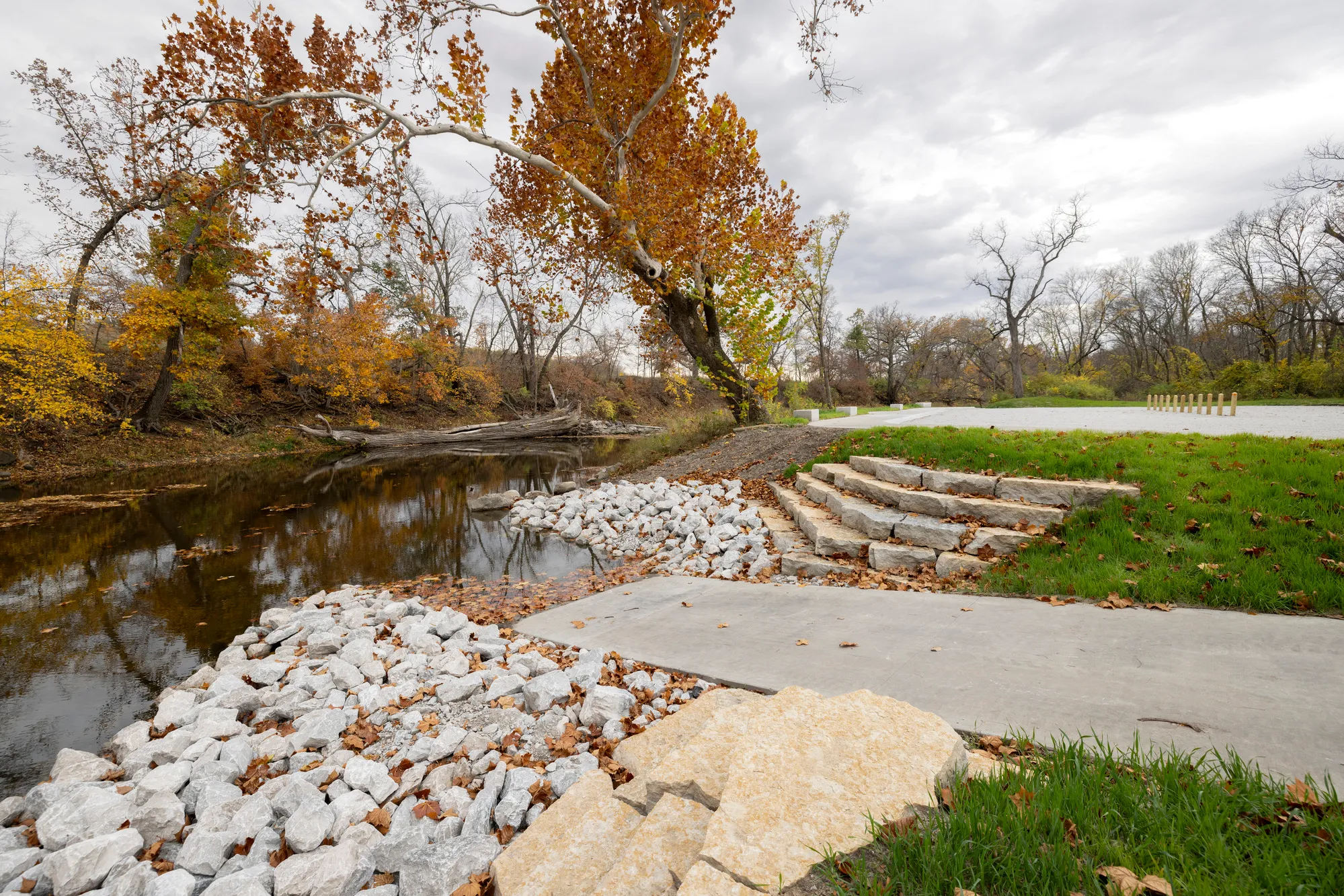
Urban Stormwater
When it comes to urban stormwater, we push the standard. Our multi-disciplinary approach brings architects, engineers, environmental professionals, and planners together to elevate solutions beyond what’s typical. Whether addressing flooding and stormwater challenges or providing feasibility assessments, ISG adopts a system-wide approach to identify priority areas, including storage and conveyance projects.
Our sustainable solutions address today’s challenges while keeping an eye on the future. We ensure accuracy using targeted technology tools including XPSWMM, HydroCAD, HEC-RAS, InfoWorksICM, and 2D system modeling of urban environments. Climate modeling for future conditions can help you stage capital improvement projects for long-term investment planning.
Expertise
- Construction Staking, Observation, and Management
- Conveyance Analysis + Planning
- Data + Technology Solutions
- Environmental Assessments + Enhancements
- Feasibility Studies
- Floodplain Assessment + Management
- Grants + Funding Assistance
- Green Infrastructure
- Hydraulic and Hydrologic 1D and 2D Modeling
- Lake, Stream, and Wetland Restoration
- Master Planning
- MS4 Permitting + Compliance
- Nature Based Design
- Stormwater Infrastructure Design
- Water Quality Modeling + Trading
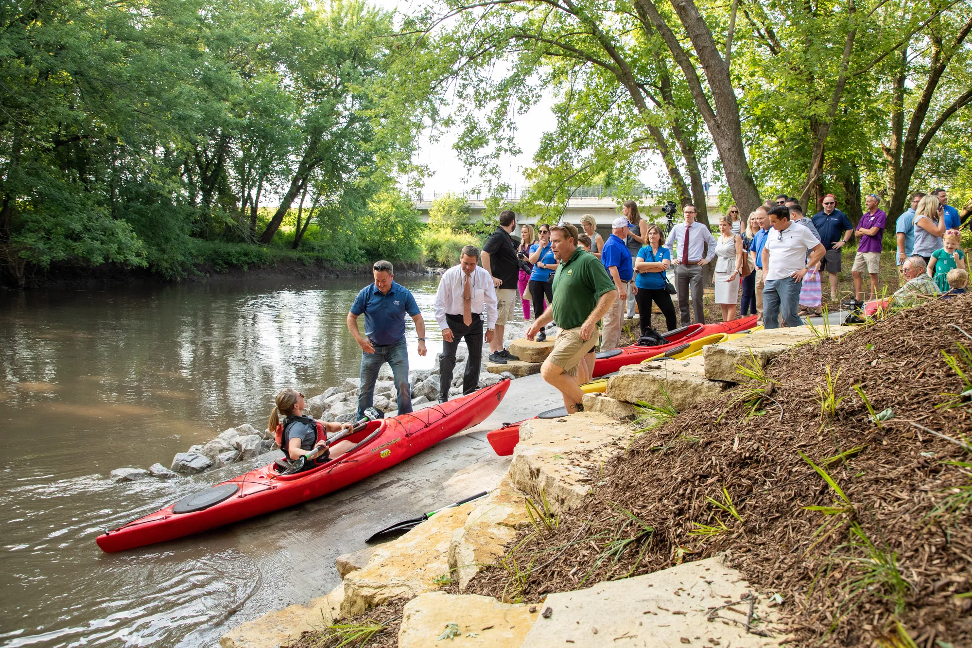
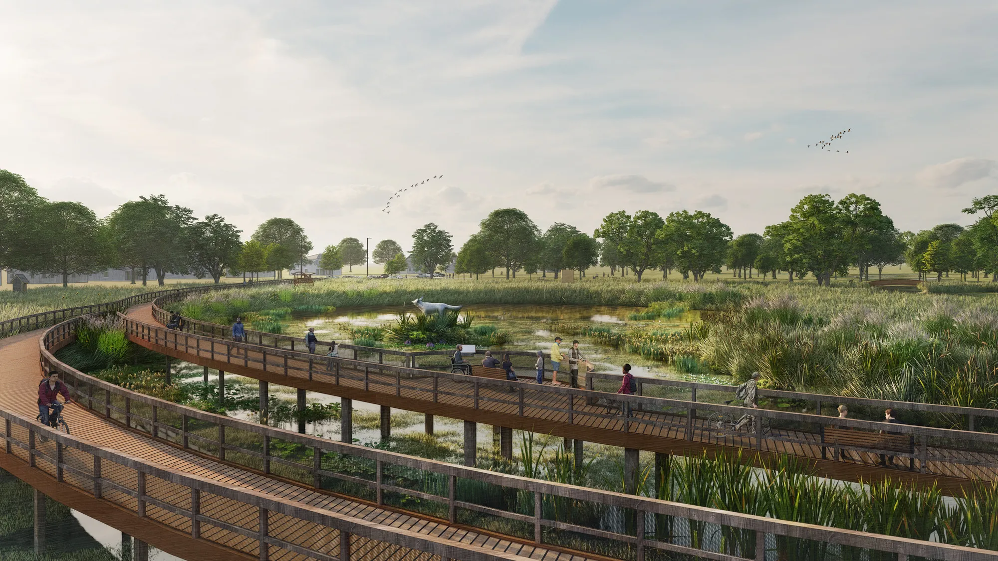
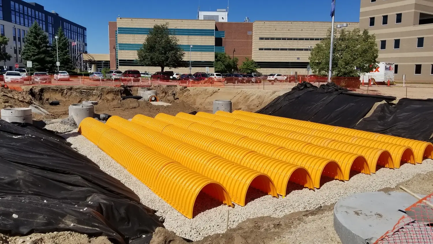
Urban Stormwater Portfolio

_webfull.webp)
.webp)

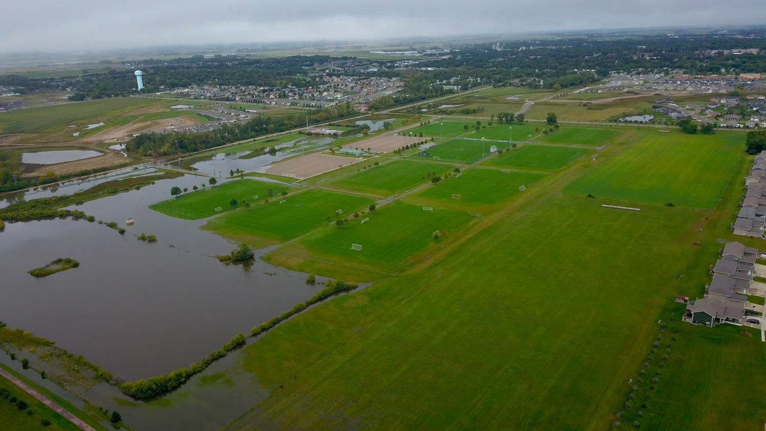
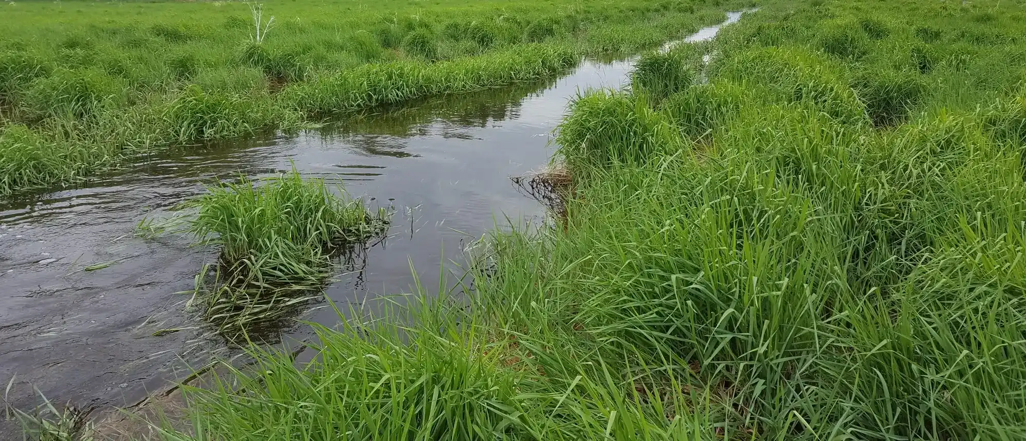
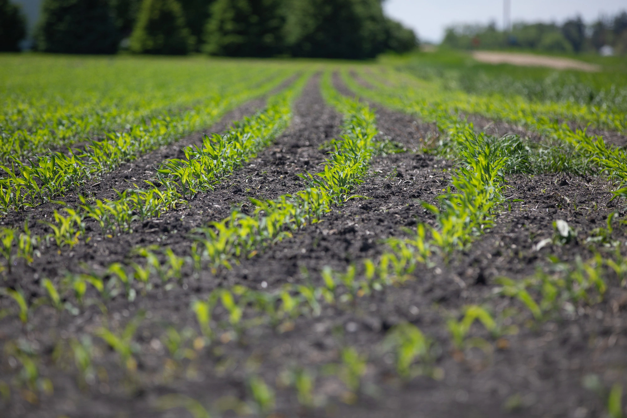
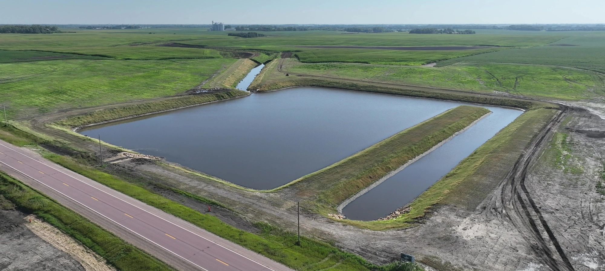
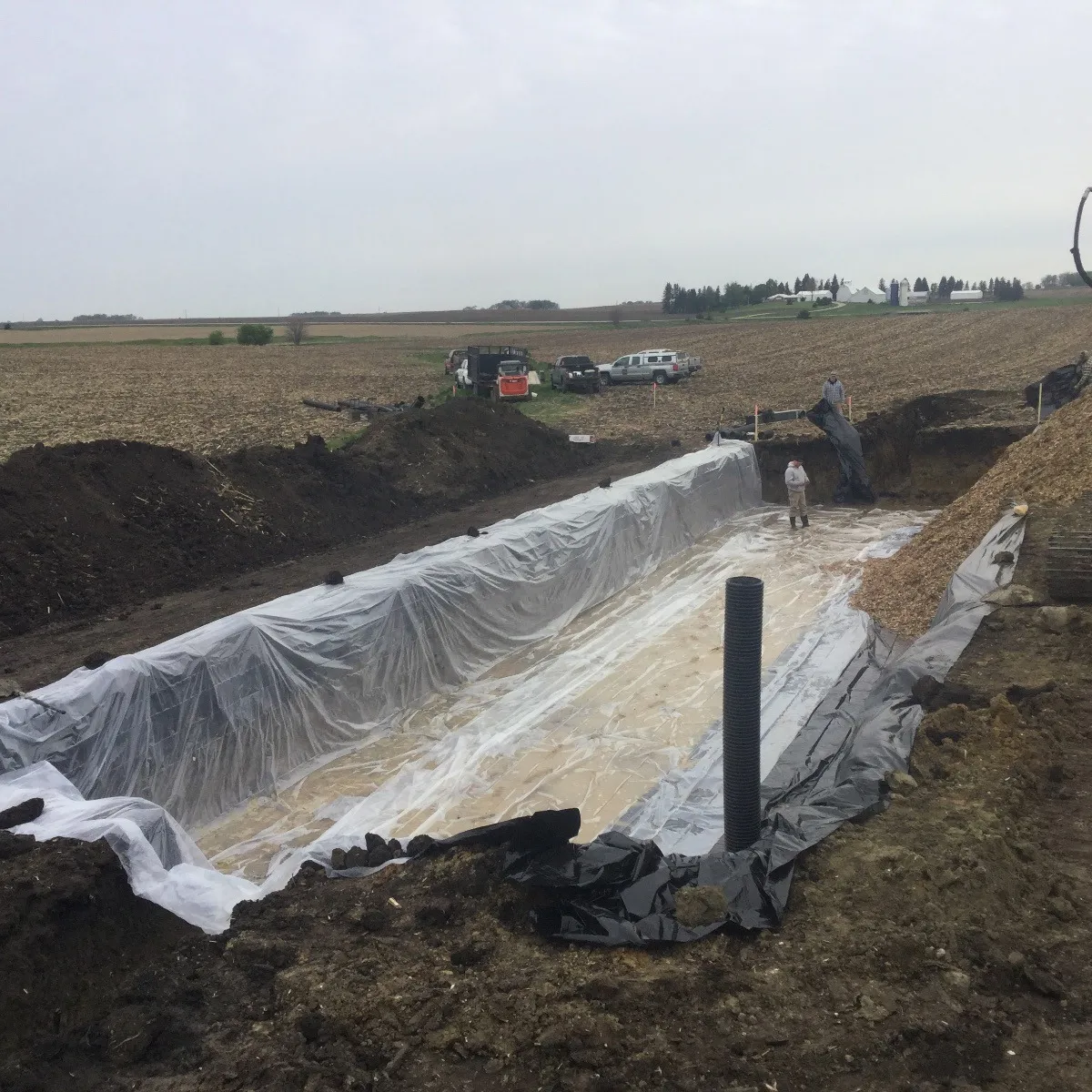
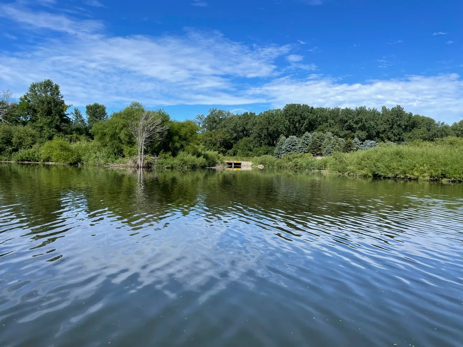
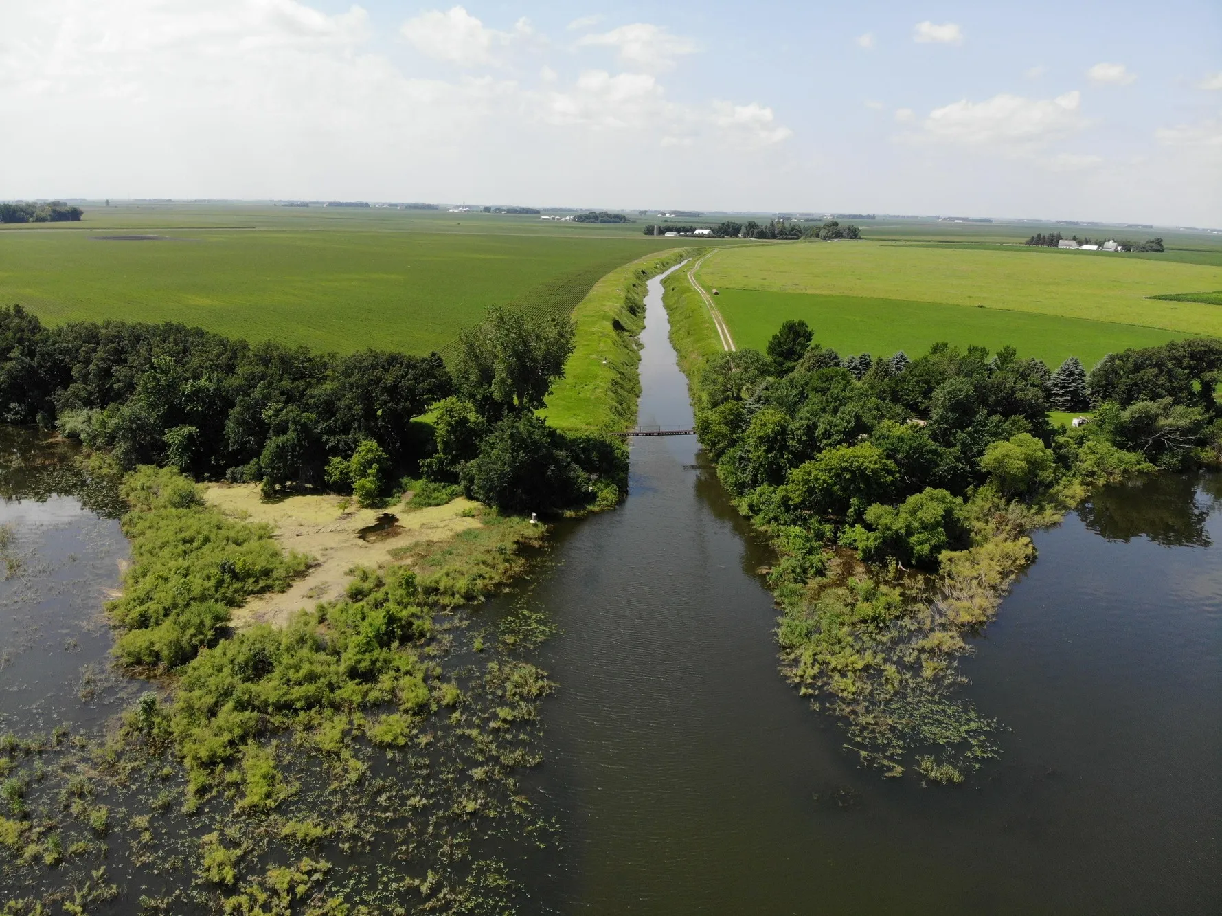
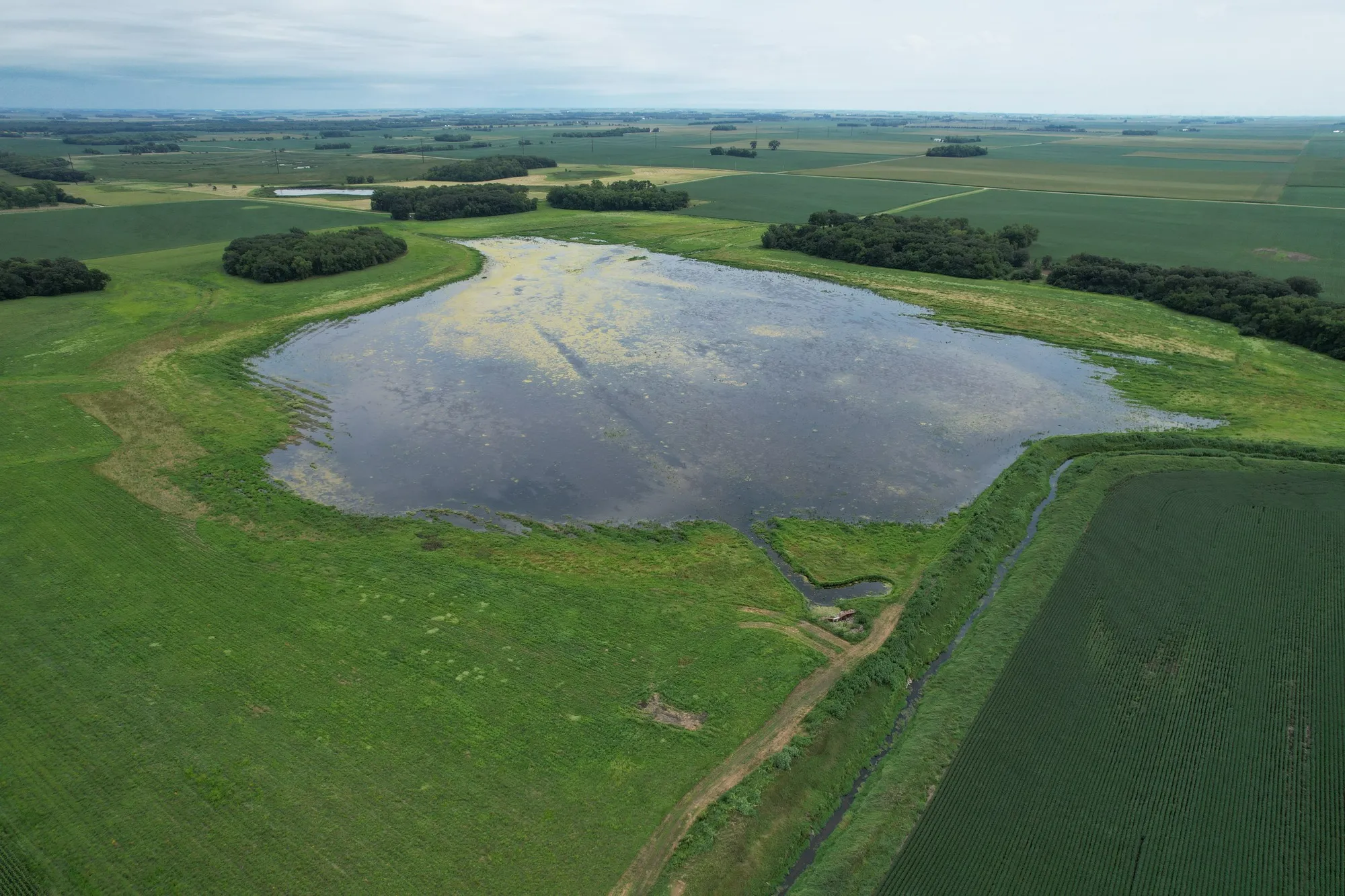
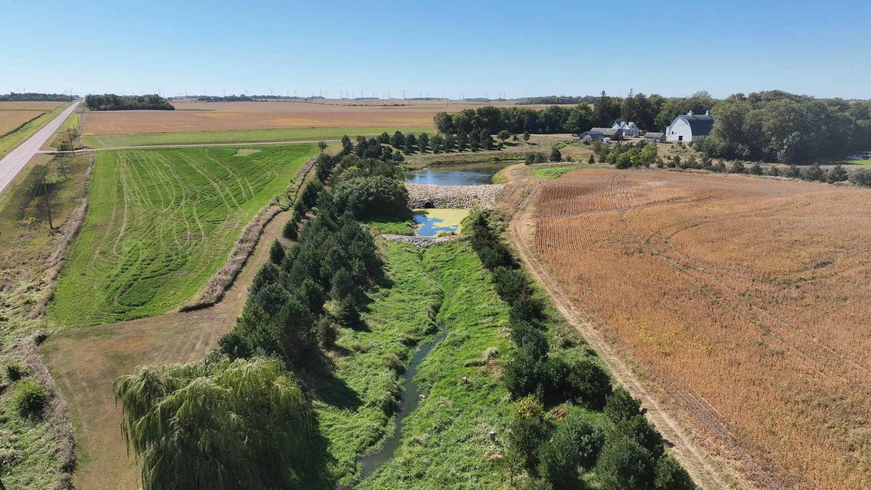
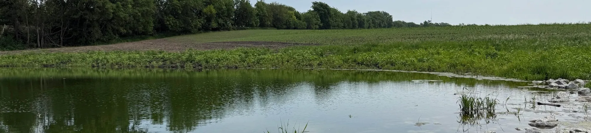
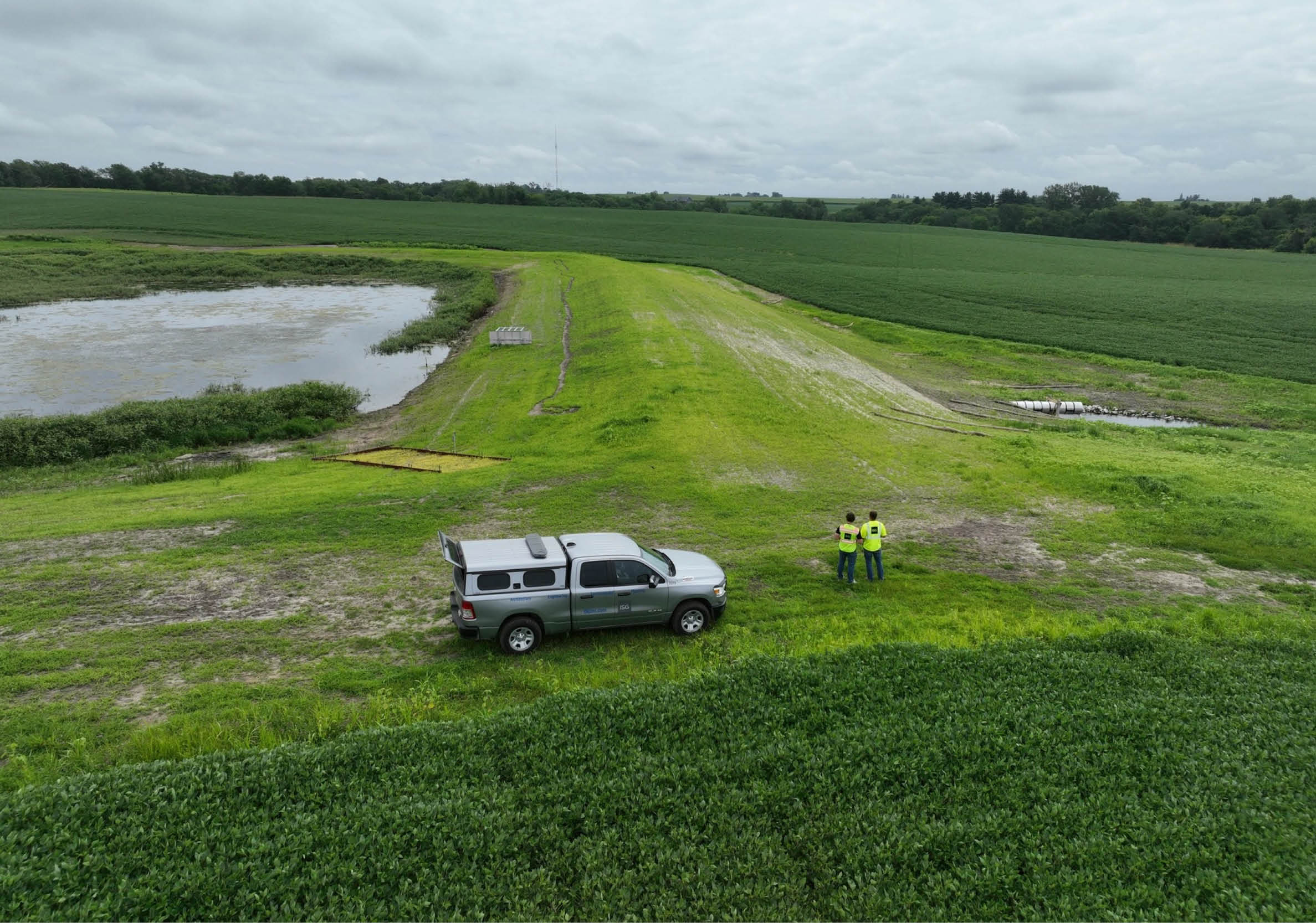
Rural Surface Water
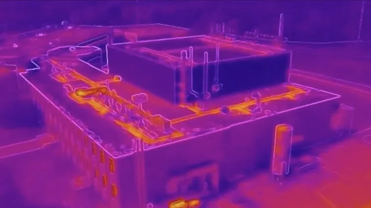
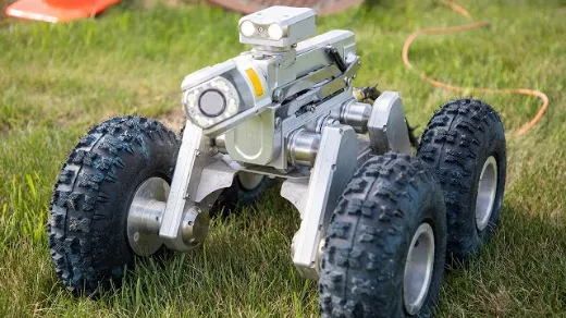
ISG champions balanced water solutions at the nexus of agriculture and ecology. Sophisticated hydrologic and hydraulic modeling will help you see current conditions and the impacts from planned projects. Embracing innovative technology solutions, including drones, LiDAR drones, and pipe crawlers, we accelerate the assessment of pipe and surface conditions while documenting changes from historical records.
Collaborating with landowners, ISG designs drainage systems that provide agricultural lands with property drainage capacity while incorporating storage strategies to manage water volume and address precipitation variability throughout the growing season. With customized on-channel, off-channel, and edge-of-field best management practices (BMPs), we reduce your future maintenance costs while improving downstream water quality.
Expertise
- Bridges + Culverts
- Construction Staking, Observation, and Management
- Drainage Studies + Reports
- Drainage Water Recycling
- Drone, Pipe Crawler, and Survey
- Flood Control + Protection
- GIS Mapping + Geospatial Analysis
- Grants + Funding Assistance
- Hydraulic + Hydrologic Modeling
- Multi-Purpose Drainage Management Plans
- Stakeholder Engagement + Collaboration
- Streambank Stabilization + Restoration
- Two-Stage Ditches
- Water Quality Best Management Practices
- Wetland Delineation + Banking
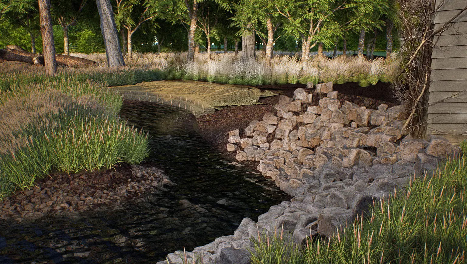
Rural Surface Water Portfolio
_1.webp)
-1.webp)
-1.webp)
.webp)


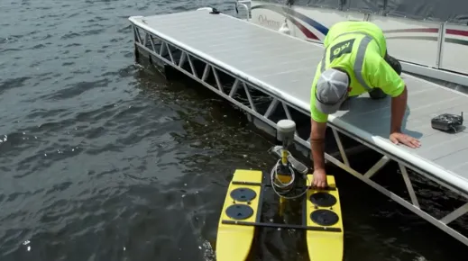
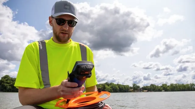
Water Quality + Planning
A leading watershed analysis, planning, and implementation firm, ISG facilitates complex watershed planning processes to generate consensus and prioritize realistic solutions that move the needle on improved water quality. We are well-qualified to provide you precise surface water monitoring, implementable water quality improvement plans with measurable goals, and comprehensive stakeholder engagement tailored to each project.
Our expert environmental planners and scientists have experience in local, state, and federal policy development and understand the outcomes needed to secure funding. We combine our technical skills with a listen-first approach, to gain a full understanding of local issues and concerns, leading to plans that get results from day one.
Expertise
- BMP Prioritization, Planning, and Implementation
- Community Engagement
- Ecological Restoration Plans
- Feasibility Studies
- Floodplain Assessment
- GIS Mapping + Geospatial Analysis
- Grants + Funding Assistance
- Hydraulic and Hydrologic 1D and 2D Modeling
- Master Plans
- Resilience Plans
- Sub-Watershed Assessments
- Water Quality Modeling + TMDL Studies
- Water Quality Monitoring + Data Analysis
- Watershed Management Plans
Water Quality + Planning Portfolio
-1.webp)


.webp)
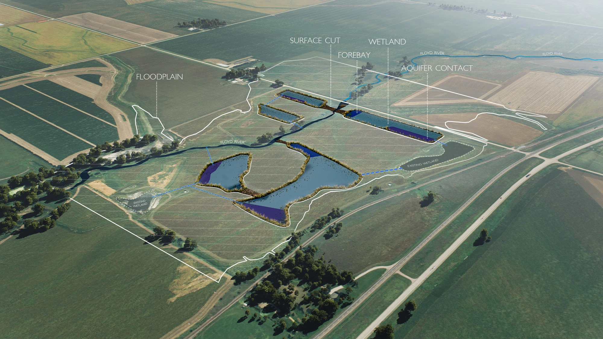
Natural Resource Management
Humble in our approach and established as a go-to leader in water resources management, ISG’s depth of expertise runs deep. Whether in large watersheds facing ecosystem challenges or in regions experiencing drought, we offer complete natural resource and ecological restoration solutions for lakes, streams, and wetlands. This resilience planning will bring lasting environmental impact to your region. Our comprehensive environmental and development services include permitting at local, state, and federal levels to ensure environmentally responsible development.
As environmental conditions change, ISG remains flexible and nimble in its management of natural resources to realize multi-benefit solutions. Our multi-disciplinary expertise, boots-on-the-ground experience, and trusted relationships with landowners, municipalities, and state agencies work in harmony to protect, conserve, and restore our valuable assets. Using a holistic lens, we consider the diverse ecological system of a resource to preserve its wild integrity while maximizing the social and economic benefits for communities.
Expertise
- Calcareous Fen Management
- Dam Mitigation + Fish Passage
- Ecological Restoration
- Ecosystem Service Mitigation + Banking
- Endangered + Threatened Species Evaluations
- Field Monitoring Services
- Habitat Management Planning
- Nature Based Solutions
- Natural Channel, Oxbow, and Shoreline Restoration
- NEPA Assessments
- Permitting + Compliance
- Plant Ecology
- Stream + Lake Restoration
- Tree Inventories
Natural Resource Management Portfolio
-1.webp)
-1.webp)

The ISG
Difference
ISG water resources engineers aren’t afraid to get our feet wet to mitigate risks for our clients. We take a consultative approach to identifying issues, building consensus, and navigating regulatory and construction processes.
We balance the protection of water resources with growing demands and will work as an extension of your team to determine feasible solutions that will help you achieve your region’s goals.
- Permitting + Regulatory Expertise
- Boots On the Ground Experience
- Large Portfolio of Work
Business Unit Experts

Julie Blackburn, CFM


Chuck Brandel, PE

Paul Marston, CFM


Bailey Bocchino, PE

.jpg)

.jpg)


I have over 15 years of working closely with ISG on various projects, I have been very impressed and satisfied with their designs and work. ISG is willing to work with landowners, county staff, DNR, BWSR, and many other agencies to design something that works. Their efficiency, experienced, and quality of work speaks for itself.
Blueprints + Building Blocks
Dream, draw, and build the future with ISG!
The Latest From ISG

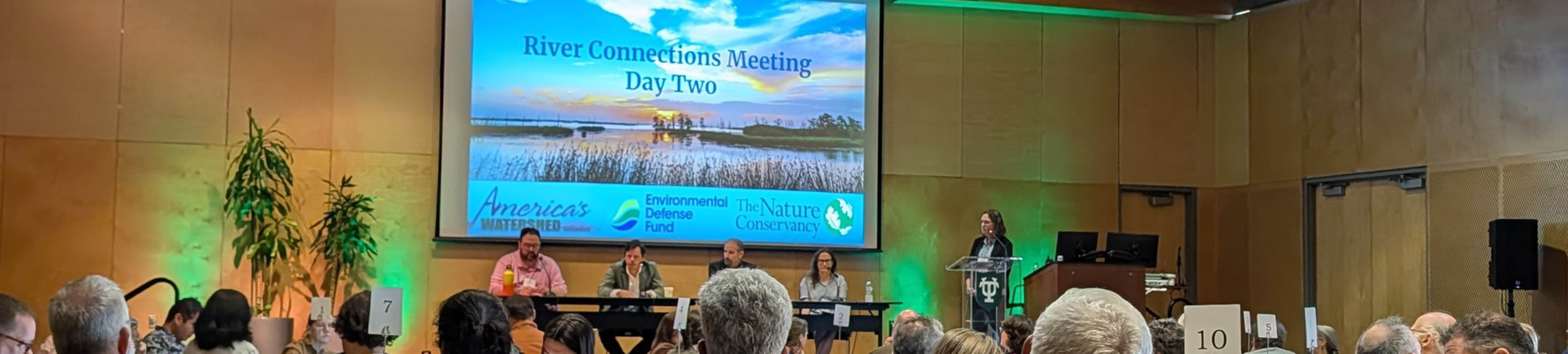
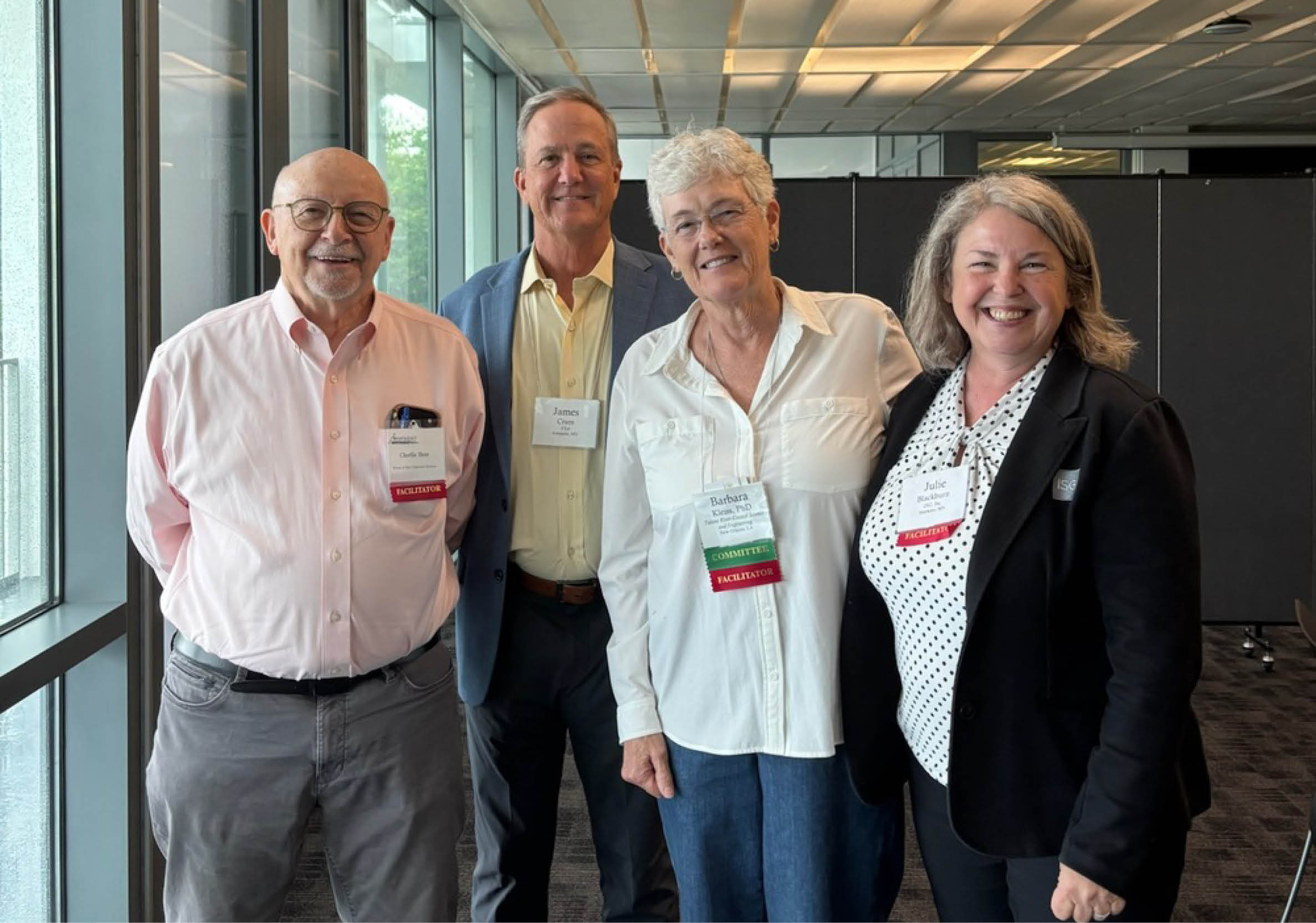
Five Takeaways from River Connections: A Science + Strategy Workshop for the Mississippi River Watershed
Science and Strategy Workshop for the Mississippi River Watershed, hosted by Tulane University in partnership with America’s Watershed Initiative and The Nature Conservancy, brought together practitioners from across the 31-state Mississippi River Basin to explore how research, policy and implementation are aligning to address shared challenges.

_webfull.webp)
ISG’s Innovative Drainage Project Recognized as ACEC State and National Honoree
ISG’s Martin County Ditch No. 28 Nutrient Treatment Train project has received two honors: the 2026 ACEC Minnesota Engineering Excellence Grand Award and the ACEC National Engineering Excellence Award, recognizing innovative engineering solutions that improve drainage performance while protecting water quality.
.webp)
.webp)
.webp)
.webp)
_webfull.webp)
_webfull.webp)
The Future Of Southern Minnesota Lakes Conference Highlights Lake Solutions + New Lake Management Workshop
ISG’s 2026 Future of Southern Minnesota Lakes Conference brought together lake advocates, researchers, and local leaders to share solutions and launch a hands-on Lake Management Workshop for improving regional lake water quality.
Let's Chat.
