From “Where am I?” to “Who am I?”: The Evolution of Geographic Information Systems and its Application in the A/E Industry
How GIS has Changed Over Time
In the broadest sense, Geographic Information Systems (GIS) help us understand where we are in the world spatially. Examining spatial correlation, how close or far things are from each other, has been an important advancement in understanding human activity. The history of this science began as maps. In the early 1800s, scientists developed maps and location points to track and control the outbreak of diseases. These location points or as we now refer to them, spatial data, revolutionized the function of maps and how their data could be analyzed.
What we now think of as GIS, the ability to store, collate, and analyze data, began to take shape once computerized, multi-layered mapping was developed as a new discipline in the 1960s. Several decades later, GIS shifted again to data sharing across industries and user-friendly, open-source tools for geospatial analysis, like OpenStreetMap, a community-driven, editable geographic database of the world. The technology and data have become increasingly accessible to different user groups and anyone in the world has access to these free tools and GIS resources.
Taking Data Relationships to the Next Level
The expanded breadth of data collected from geographic locations has caused an even greater evolution in GIS—a movement from spatial relationships to statistical data relationships—leading to the development of new outputs. For instance, geospatial technology has been used to collect voter location information and generate voting precinct maps. Now, that same technology collects voter information to generate individual ballots for those polling locations.
Due to the invention and acceptance of the personal cell phone, millions of data points are captured on individuals, collecting information on every purchase, preference, and product we search. Data that was once captured every 10 years, is now gathered daily, creating geographic DNA profiles on individuals and the ability of businesses and industries to predict future needs and trends.
Embracing the Future
With this proliferation of data sources comes a need for GIS practitioners to make sense of the data and use it to solve today’s complex problems. ISG’s GIS team is challenging old assumptions about how to apply GIS technologies in the architecture and engineering industry by combining cutting-edge mapping and spatial analysis technology with other advanced software to better understand our clients and help them reach their goals. Below are five ways ISG is leveraging GIS technologies:
1. Design
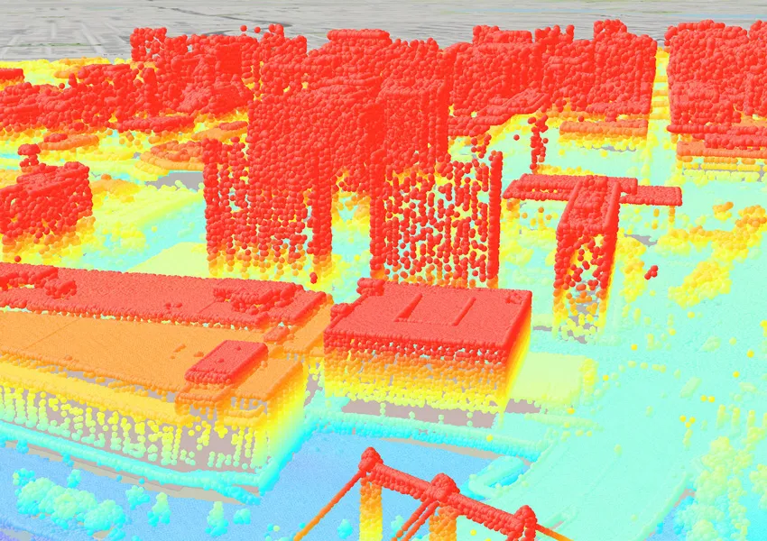
The GIS industry has experienced a significant migration to 3D applications, adding layers of design detail that influence real-time, accurate decision-making versus design assumptions. These 3D representations create an impactful depiction of the project vision and help to mitigate any potential issues in construction.
2. Operations
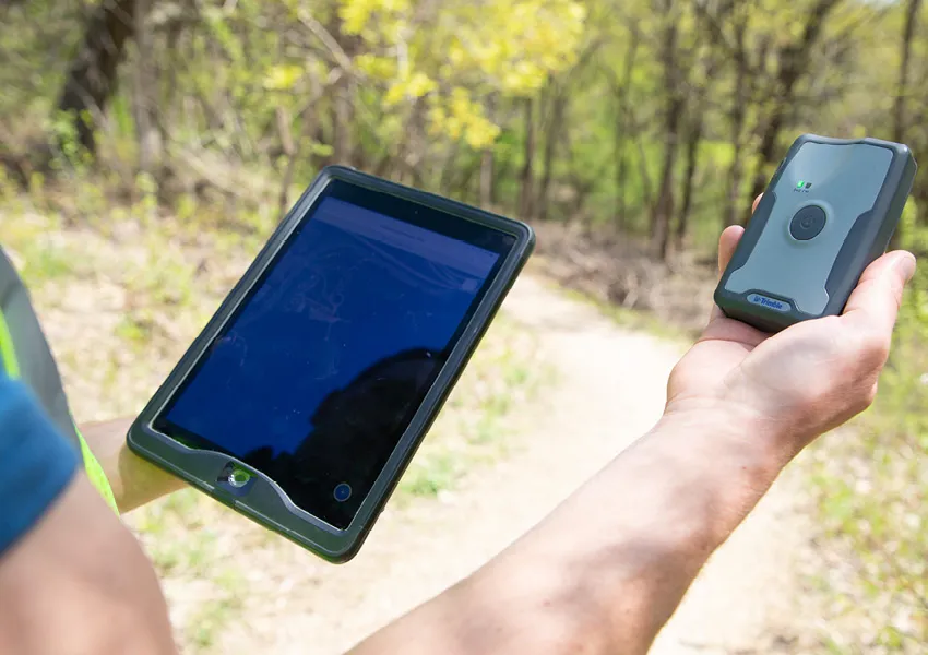
ISG’s unique approach to GIS services allows for seamless communication between design teams and on-site conditions. These services streamline the collection of highly accurate, interactive site data and improve internal workflows and efficiencies. Supported by software like Survey123 and Field Maps, the GIS team collects and organizes necessary data. By understanding specific characteristics of the site, ISG designers use this information to visualize and plan for the exact conditions of each location, allowing for the successful blend of real-life conditions with the client’s vision.
3. Demographics
Using Esri’s Business Analyst tool, ISG can develop a complete understanding of a specific community. With the ability to query over 15,000 variables, including population growth, commute times, recreational activities, and travel habits, ISG helps clients understand the economic, socioeconomic, and social climate of the area to strategize development needs that will resonate with their community.
4. Engagement
Digital storytelling has taken community engagement to the next level and broken down barriers to access and equity ensuring that all stakeholder voices are represented. Interactive websites, videos, maps, and surveys are tailored for each project and offer effective deliverables to garner expanded participation.
5. Asset Management
ISG’s innovative GIS technology provides public and private sector clients with tools to manage large-scale infrastructure and plan for the future. Easy to navigate, custom maps can house comprehensive assets like utility and signage locations or help monitor manufacturing performance to determine growth and decline in facilities around the world.
6. Analysis
One of the most valuable contributions by ISG’s GIS team is their objective analysis of applicable data to solve problems. There is a science in understanding how to use data effectively and derive meaning from what the data can tell you. An excellent example of this analysis was ISG’s recent partnership with a farm credit cooperative in the upper Midwest who needed to assess its locations and facilities after significant expansion and acquisitions. ISG honed-in on different iterations of location analysis to develop the best variables based on the needs of the cooperative’s clients and employees. By analyzing everything from healthcare, childcare, and housing to the location of the nearest farm implement dealers, ISG sifted through thousands of data sets to help the company make informed decisions and pinpoint prime locations for business.
Spatial and statistical data is only useful if actionable knowledge is filtered in a meaningful way. As the geospatial industry develops and expands, ISG remains flexible and responsive to how the world analyzes and uses this information. Rapid technological advances are shaping the way we deliver services to clients and impacting designs and deliverables in exciting new ways.


Related Articles


Five Takeaways from River Connections: A Science + Strategy Workshop for the Mississippi River Watershed
Science and Strategy Workshop for the Mississippi River Watershed, hosted by Tulane University in partnership with America’s Watershed Initiative and The Nature Conservancy, brought together practitioners from across the 31-state Mississippi River Basin to explore how research, policy and implementation are aligning to address shared challenges.